
Functions
Ref. Model
I/O Data
SubAIMs
JSON MData
Profiles
Ref. Software
Conformance
Performance
1 Functions
The Spatial Attitude Generation (CAV-SAG) AIM:
| Receives | GNSS Object | From the GNSS receiver, at the boundary of the ESS. |
| Spatial Attitude | From the Motion Actuation Subsystem. | |
| Basic Offline Map Object | The Offline Map. | |
| Produces | Ego Spatial Attitude | To Basic Visual Scene Description and Basic Environment Description. |
The AIM produces the ego Spatial Attitude of the CAV on one frame: east, north and up in metres from the origin of the Offline Map when the ESS has it – the frame of the Autonomous Motion Subsystem – and from the first GNSS fix otherwise.
A complementary filter combines the two sources: the ego position is the track the Motion Actuation Subsystem reckons plus an offset, which each GNSS fix moves towards what it says; the heading of the track is corrected by the direction the GNSS fixes travel. The accuracy stated grows with the distance run since the last fix; before any fix, the Spatial Attitude is on the odometry’s frame, and its accuracy says it is not anchored.
2 Reference Model
Figure 1 depicts the Reference Model of the Spatial Attitude Generation (CAV-SAG) AIM.
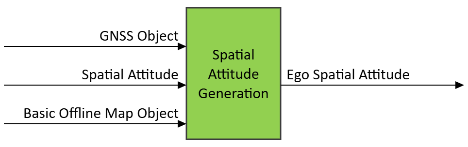
Figure 1 – The Spatial Attitude Generation (CAV-SAG) AIM
3 I/O Data
Table 1 specifies the Input and Output Data of the Spatial Attitude Generation (CAV-SAG) AIM.
| Input | Data Type | Description |
|---|---|---|
| GNSS Object (optional) | GNSS Object | The CAV’s position as GNSS gives it: absolute, noisy, at a low rate, lost in tunnels. |
| Spatial Attitude | Spatial Attitude | The CAV’s Spatial Attitude by odometry and inertial sensors: smooth, frequent, drifting. |
| Basic Offline Map Object (optional) | Basic Offline Map Object | The map whose origin is the frame of the Spatial Attitude. |
| Output | Data Type | Description |
| Ego Spatial Attitude | Spatial Attitude | The ego Spatial Attitude – position, orientation, their velocities and accelerations, with their accuracies – on the frame of the Offline Map. |
4 SubAIMs
No SubAIMs.
5 JSON Metadata
https://schemas.mpai.community/CAV2/V2.0/AIMs/SpatialAttitudeGeneration.json
6 Profiles
No Profiles.
7 Reference Software
The reference software implements the AIM as a complementary filter: the ego position is the track the Motion Actuation Subsystem reckons plus an offset that each GNSS fix moves towards what it says (setting GnssWeight); the heading of the track is corrected by the direction the GNSS fixes travel. The frame is that of the Offline Map. It is part of the reference software of CAV-TEC V2.0 (see N4195, An introduction to the reference software): C# on .NET 10, released under the BSD 3-Clause licence, obtained from MPAI.
Tested with the Environment Sensing Subsystem, Stage 1: the Spatial Attitude on a synthetic drive against the ground truth.
8 Conformance Testing
Table 2 provides the Conformance Testing Method for the Spatial Attitude Generation (CAV-SAG) AIM: the data it receives and produces. If a schema references other schemas, conformance of data for the primary schema implies that data referencing a secondary schema shall also validate against that schema, if present, and conform with the Qualifier, if present.
| Receives | GNSS Object | Shall validate against the GNSS Object schema. |
| Spatial Attitude | Shall validate against the Spatial Attitude schema. | |
| Basic Offline Map Object | Shall validate against the Basic Offline Map Object schema. | |
| Produces | Spatial Attitude | Shall validate against the Spatial Attitude schema. |